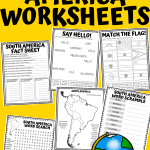
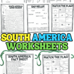
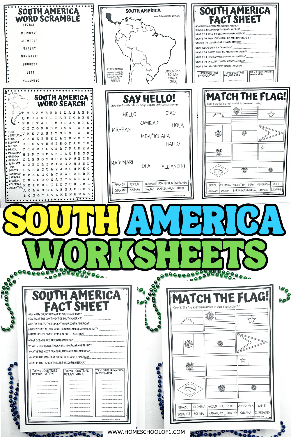
Free South America Worksheets for Kids (Maps, Flags, Facts & More)
These free South America worksheets were a great addition to our geography lessons, combining maps, flags, facts, and language activities in one printable pack.
They helped my son stay focused while learning about the continent in a hands-on way, and the variety made it easy to adapt for different ages.
I’ve included answer sheets too, which makes them simple to use at home or in the classroom.
**This post may contain affiliate links. As an Amazon Associate and a participant in other affiliate programs, I earn a commission on qualifying purchases.**
Fun Facts About South America for Kids
These quick facts are a great way to introduce the continent before using the South America worksheets. They help spark curiosity and give kids some memorable context for what they’ll be learning.
- Llamas, alpacas, and vicuñas are all native to South America and have been domesticated for thousands of years.
- The Galapagos Islands off the coast of Ecuador helped inspire Charles Darwin’s theory of evolution.
- The capybara, the world’s largest rodent, can be found across much of the continent.
- Rio de Janeiro hosts the world’s largest carnival celebration, with millions attending each year.
- The ancient city of Machu Picchu in Peru was built by the Incas in the 15th century.
- Arapaima, a freshwater fish found in the Amazon, can grow up to 10 feet long.
- The Atacama Desert in Chile is one of the driest places on Earth, some parts haven’t seen rain in over 500 years.
- The Andes Mountains stretch through seven countries and form the longest mountain range in the world.
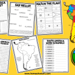
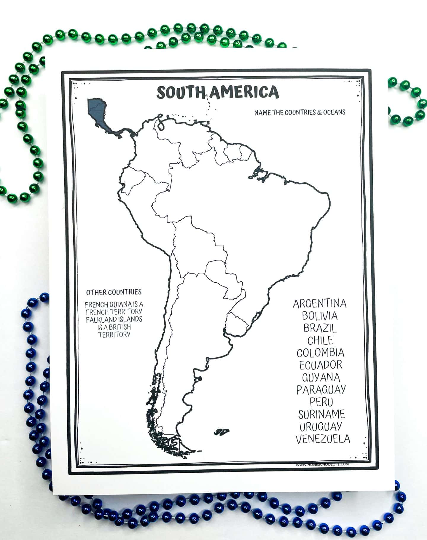
South America Map Worksheet
This activity includes two versions of the South America map, one with labeled countries on the side to help kids get started, and another with no labels for more of a challenge.
There are 12 independent countries in South America, but you’ll also notice two territories often included on maps: the Falkland Islands (a British territory) and French Guiana (a French territory).
Kids can either color the map or write in the country names as they go. We found this especially useful for visual learners and for reinforcing location memory before moving on to flags or capitals.
If you’re looking to extend this activity, I highly recommend the Mapology World Map Puzzle, it’s been one of our favorite geography games to pair with any continent study.
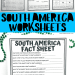
South America Fact Sheet
This printable fact sheet includes 10 geography-based questions about South America, plus three bonus lists covering population, land area, and major cities. It’s a great way to reinforce learning after completing the map and flag activities.
10 Quick Facts About South America
- How many countries are in South America? 12
- How big is the continent of South America? 6.888 million mi²
- What is the total population of South America? 422.5 million
- What is the tallest mountain in South America? Where is it? Aconcagua, Argentina
- What is the lowest point in South America? Where is it? Laguna del Carbón, Argentina
- What oceans are in South America? Atlantic and Pacific Oceans.
- What is the biggest river in South America? Where is it? Amazon River
- What is the most famous landmark in South America? Machu Picchu, Peru
- What is the smallest country in South America? Suriname
- What is the largest desert in South America? Atacama Desert, Chile.
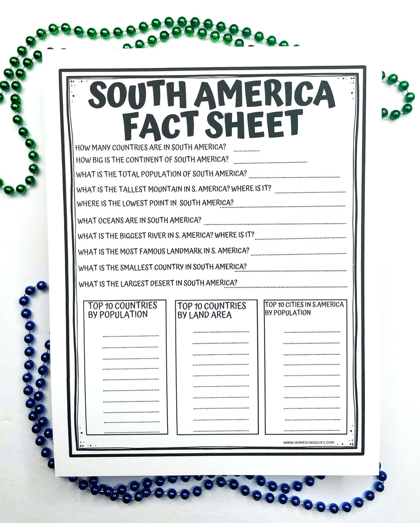
Top 10 Countries by Population
- Brazil
- Colombia
- Argentina
- Peru
- Venezuela
- Chile
- Ecuador
- Bolivia
- Paraguay
- Uruguay
Top 10 Countries by Land Area
- Brazil
- Argentina
- Peru
- Colombia
- Bolivia
- Venezuela
- Chile
- Paraguay
- Ecuador
- Guyana
Top 10 Largest Cities by Population
- São Paulo, Brazil
- Buenos Aires, Argentina
- Rio de Janeiro, Brazil
- Lima, Peru
- Bogotá, Colombia
- Santiago, Chile
- Belo Horizonte, Brazil
- Caracas, Venezuela
- Porto Alegre, Brazil
- Brasília, Brazil
If your kids enjoy trivia-style learning, we also really like the World card game for quick-fire facts and global geography practice.
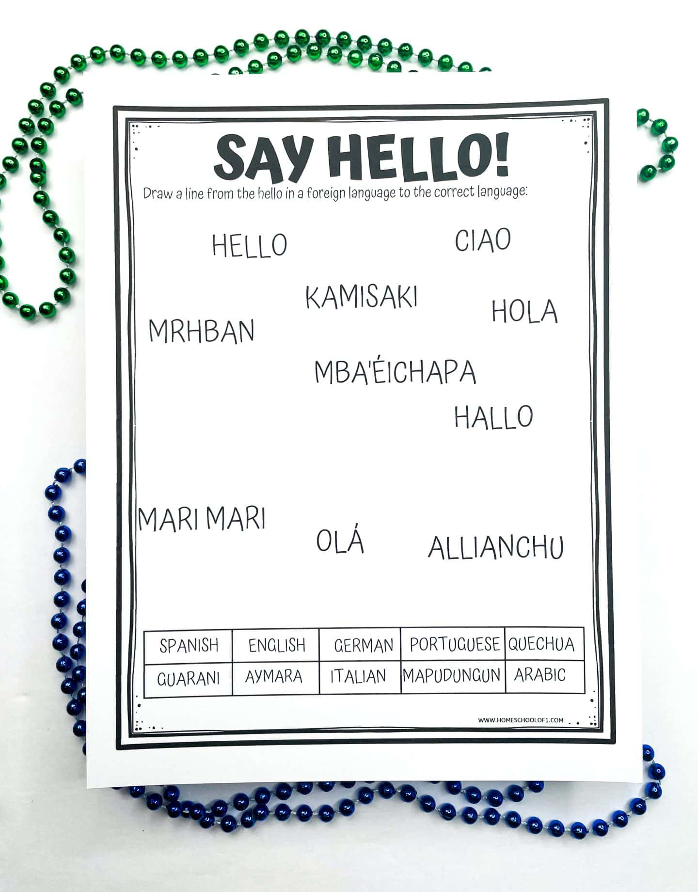
Learn to Say Hello in 10 South American Languages
This activity introduces kids to the rich language diversity across South America.
The worksheet includes 10 different greetings, and the task is to match each one to the correct language. It’s a fun way to explore culture and language beyond country borders.
Greetings to Match:
- Kamisaki – Aymara
- Hallo – German
- Hello – English
- Hola – Spanish
- Mari Mari – Mapudungun
- Mba’éichapa – Guarani
- Allianchu – Quechua
- Ciao – Italian
- Mrhban – Arabic
- Olá – Portuguese
Languages like Spanish and Portuguese are widely spoken, but this also introduces lesser-known Indigenous and immigrant languages still used in parts of South America today. Great for sparking curiosity about how culture, geography, and language connect.
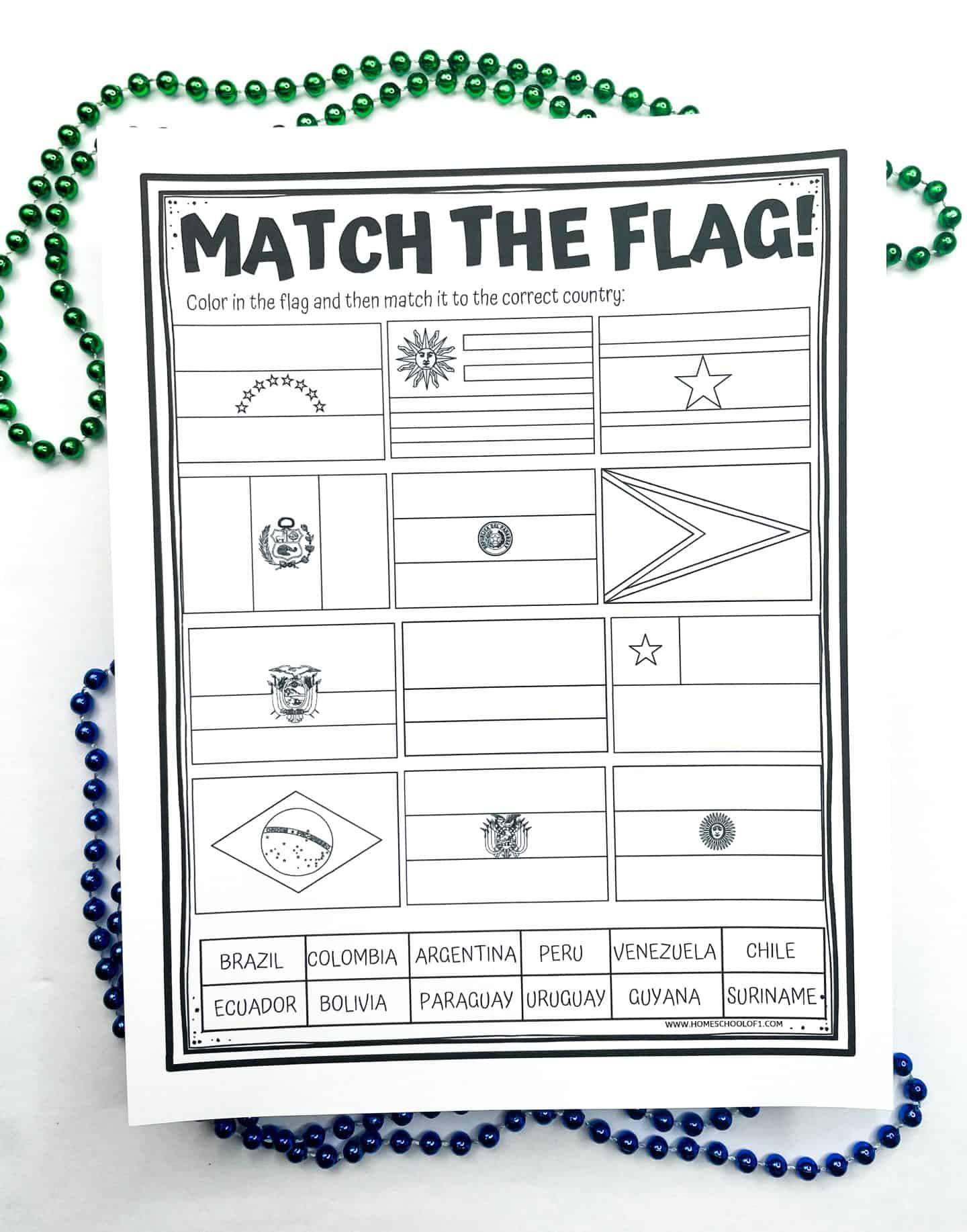
Match the Flag Worksheet
This hands-on activity helps kids learn the flags of 12 South American countries through research and coloring.
They’ll start by coloring each flag accurately, then draw a line connecting it to the correct country on the map.
Flags included:
- Brazil
- Suriname
- Colombia
- Guyana
- Argentina
- Uruguay
- Peru
- Paraguay
- Venezuela
- Bolivia
- Ecuador
- Chile
It’s a great way to reinforce country recognition, flag symbolism, and geography in one worksheet. If your kids enjoy visual challenges, the 100 Pics card game is also a fun follow-up for testing their memory of world flags.
South America Word Search
This word search is a fun way to reinforce spelling and recognition of South American countries and capital cities.
Words can appear horizontally, vertically, diagonally, forward, or backward, making it just challenging enough for upper elementary and middle school students.
An answer key is included, since a few of the words can be tricky to spot.
Tip: Use a highlighter or circle the words instead of crossing them out, some letters are used in more than one word!
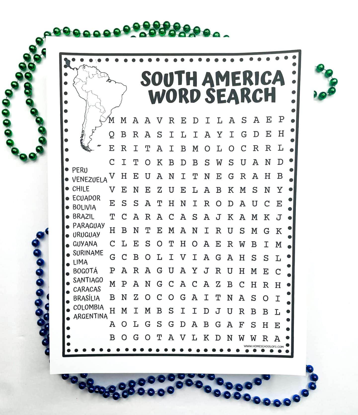
The 17 South American countries and cities to find are:
- Peru
- Venezuela
- Chile
- Ecuador
- Bolivia
- Brazil
- Paraguay
- Uruguay
- Guyana
- Suriname
- Lima
- Bogotá
- Santiago
- Caracas
- Brasília
- Colombia
- Argentina
This pairs well with the map activity or flag worksheet for reinforcing geography in a low-pressure way.
South America Word Scramble
This printable word scramble is a fun way to reinforce country names while building spelling and problem-solving skills.
There are no extra clues, just scrambled versions of 12 South American countries, making it a great brain teaser for older kids.
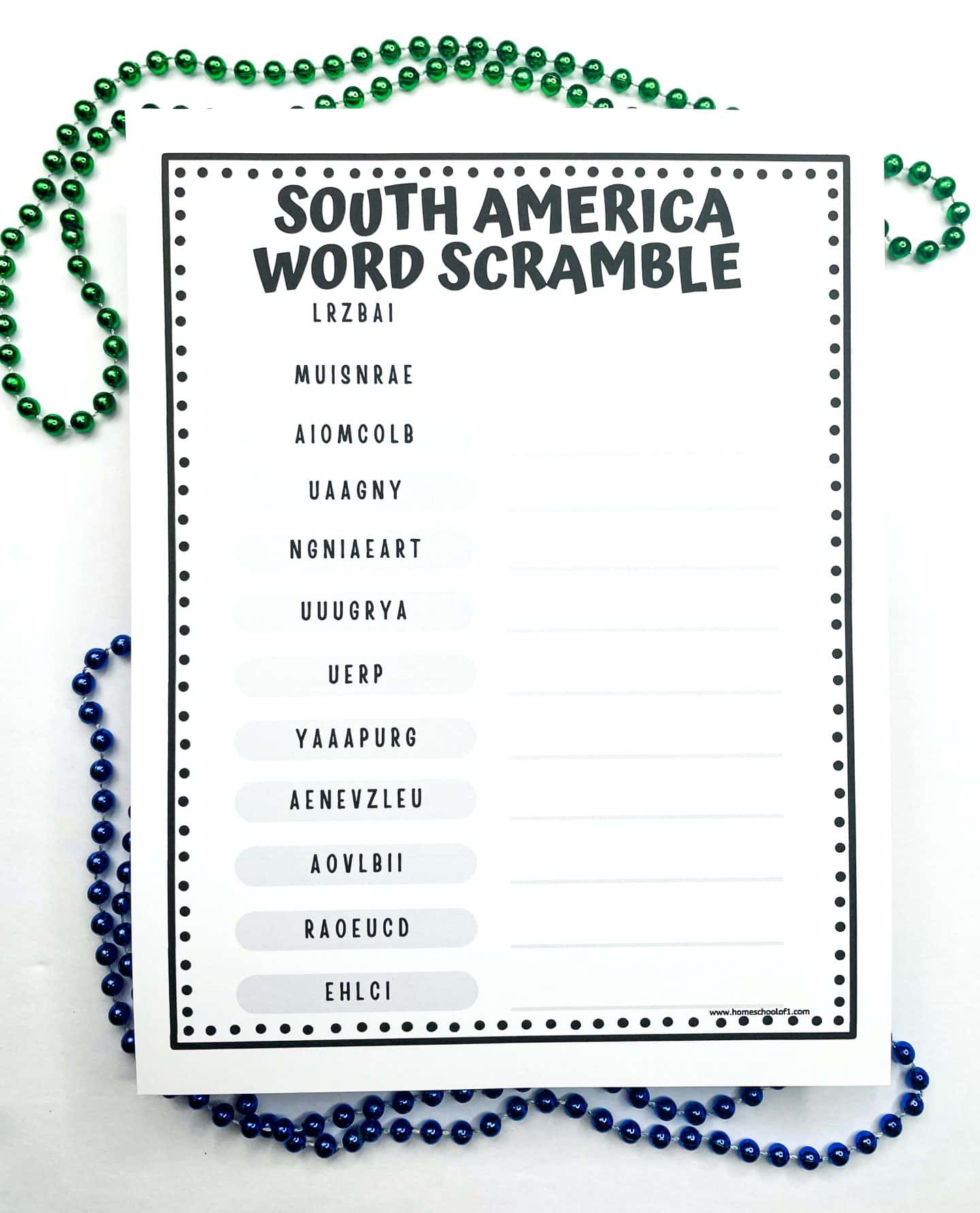
Countries included:
- Brazil
- Suriname
- Colombia
- Guyana
- Argentina
- Uruguay
- Peru
- Paraguay
- Venezuela
- Bolivia
- Ecuador
- Chile
An answer sheet is included in case anyone gets stuck. This activity works well alongside the map or fact sheet to help with country recognition and spelling.
Books About South America for Kids
These geography-themed picture books were a great way to add depth to our South America unit. My son is much more likely to remember a place if there’s a story behind it, and these books brought the continent to life in a way worksheets just can’t.
- Aztec, Inca, and Maya – A solid intro to three major ancient civilizations. It helped my son understand the bigger historical context beyond modern borders.
- Where Is Machu Picchu? – We read this before the Machu Picchu worksheet, and it gave him a much better grasp of the Inca Empire and the site’s mystery.
- Ada’s Violin: The Story of the Recycled Orchestra of Paraguay – This one really stuck with him. It’s an inspiring true story that led to a lot of good conversations about resilience and creativity.
- Waiting for the Biblioburro – A gentle story set in Colombia that introduced the idea of access to education in rural areas. Simple but meaningful.
- Love and Roast Chicken – A funny, clever folktale from the Andes. It balanced out some of the heavier history with something light and memorable.
WANT ALL OF THE CONTINENTS WORKSHEETS NOW?
More Free South American Geography Printables
If you’re looking to expand beyond the core South America worksheets, these extras have worked well for us to explore landmarks and culture more deeply.
- Christ the Redeemer worksheet – This one focuses on Brazil’s most iconic statue. It was a great way to discuss both geography and cultural landmarks while tying in some light history and architecture.
- Machu Picchu worksheet – A good follow-up after reading about the Inca Empire or completing the Peru activities. My son found the photos and facts really engaging, especially the mystery around why it was abandoned.
Get the Free Printable South America Worksheets Here!
These South America worksheets are free to use at home or in the classroom. Just scroll to the bottom of the page to access the PDF.
Ready to grab your free printable? Just pop your name and email into the form below, and it’s all yours!

If you don’t see the form below, click here to get the free South America geography worksheets.
Last Updated on 12 July 2025 by Clare Brown