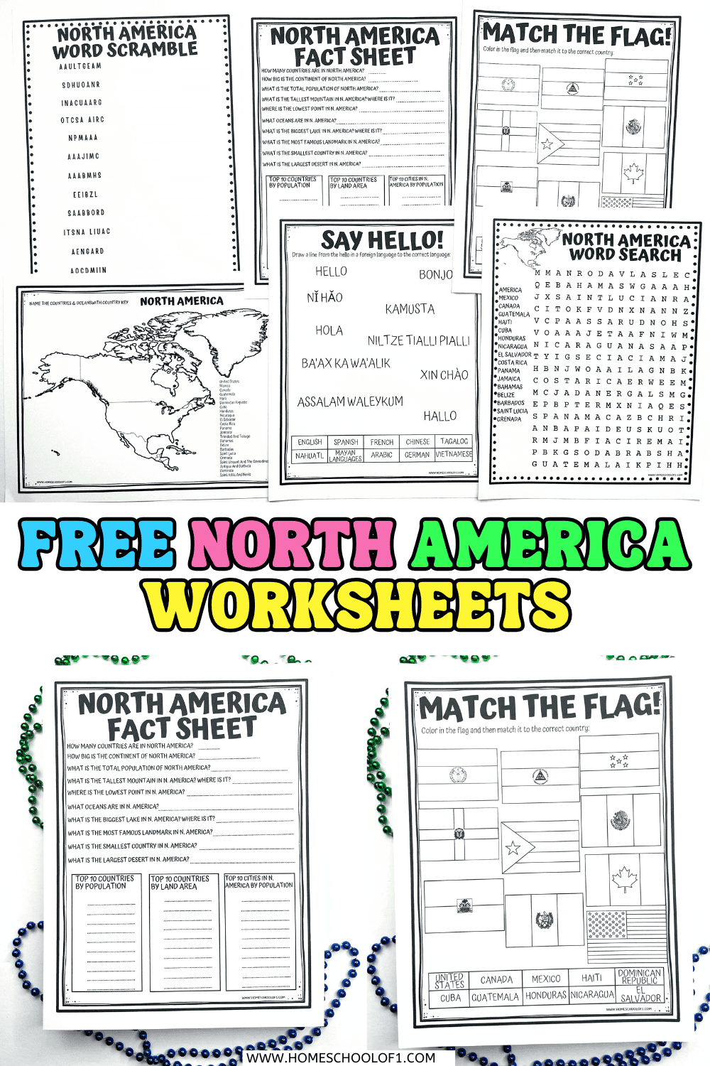
North America Worksheets (Free Geography Printables)
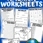
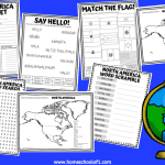
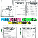
North America worksheets are a great way to help kids explore geography, culture, and facts about the continent in an engaging, hands-on format.
Whether you’re teaching in a classroom or at home, these printable activities cover everything from labeling maps and identifying flags to word scrambles, fun facts, and even learning how to say hello in 10 different languages.
They’re ideal for elementary students who are learning about the countries, landmarks, and languages of North America, and they require very little prep. You can also use random countries to turn this into a quick research or discussion activity.
**This post may contain affiliate links. As an Amazon Associate and a participant in other affiliate programs, I earn a commission on qualifying purchases.**
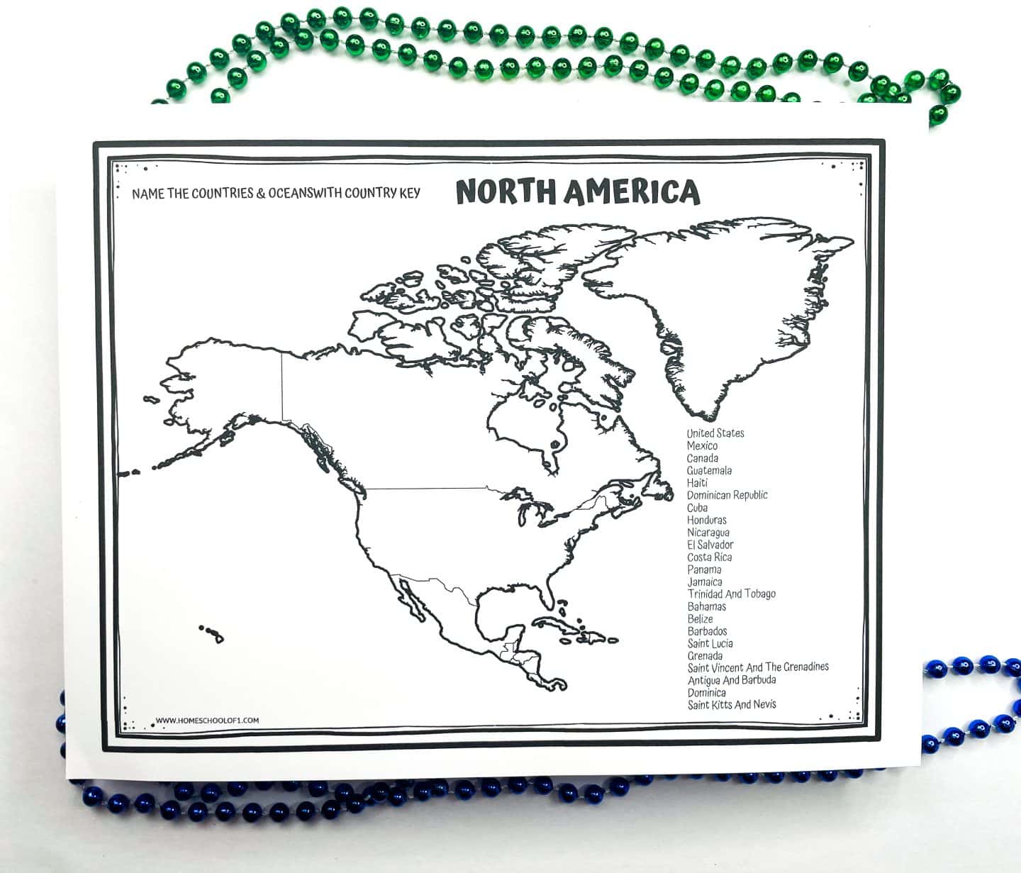
North America Map Worksheet
These printable map worksheets are a great way for kids to learn the 23 countries of North America.
One version includes a labeled country list on the side for reference, while the other is blank for more of a challenge.
Students can color each country or label them directly on the map, perfect for visual learners and geography review.
For an extra layer of learning, pair this with a North American atlas like 100 Maps: North America or the Mapology World puzzle game to reinforce locations and features through play.
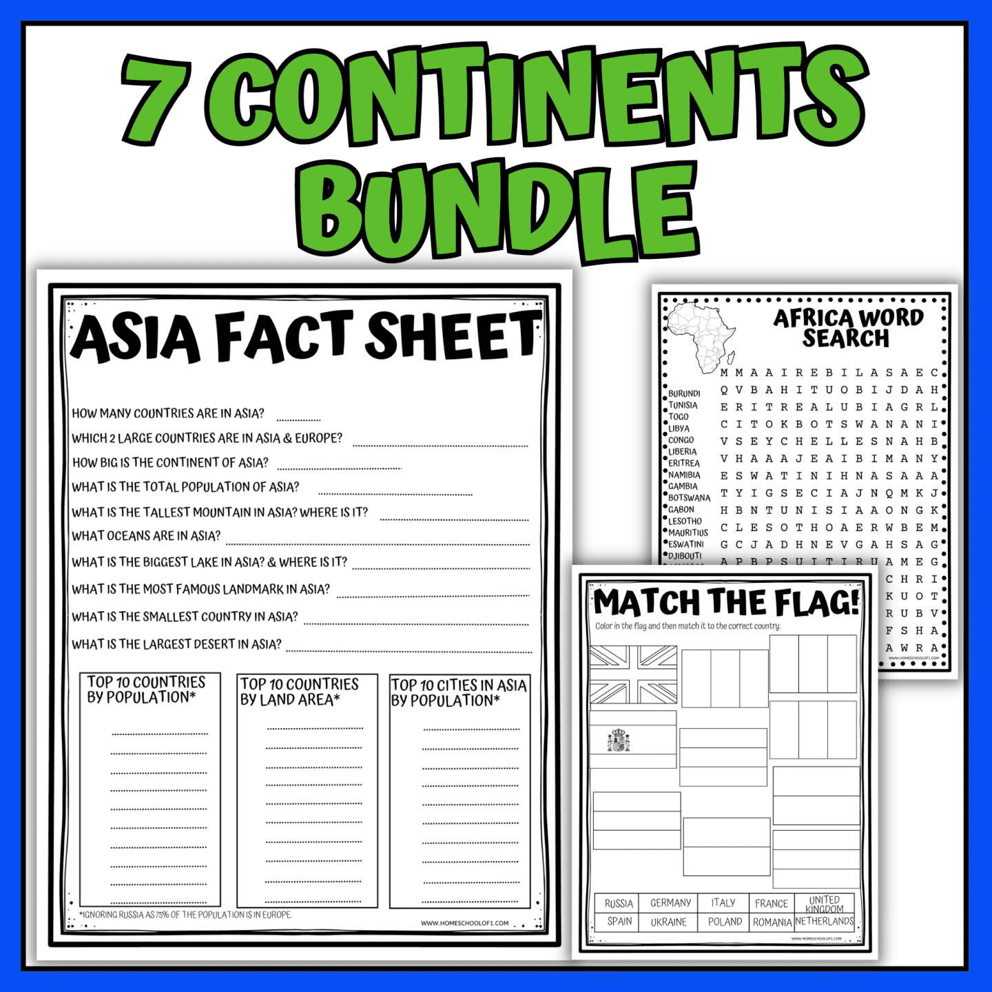
North America Fact Sheet
This printable North America fact worksheet includes 10 key questions to help students review the continent’s geography, population, and major landmarks.
It’s a great option for independent research, quizzes, or group work.
Included questions:
- How many countries are in North America? 23
- How big is the continent of North America? 9.54 million square miles.
- What is the total population of North America? 579 million people.
- What is the tallest mountain in North America? Where is it? Mount Denali, Alaska
- What is the lowest point in North America? Where is it? Death Valley, California
- What oceans are in North America? Pacific, Atlantic, and Arctic Oceans.
- What is the biggest river in North America? Where is it? Mississippi River, USA.
- What is the most famous landmark in North America? Statue of Liberty
- What is the smallest country in North America? Saint Kitts and Nevis.
- What is the largest desert in North America? Chihuahuan Desert, Mexico.
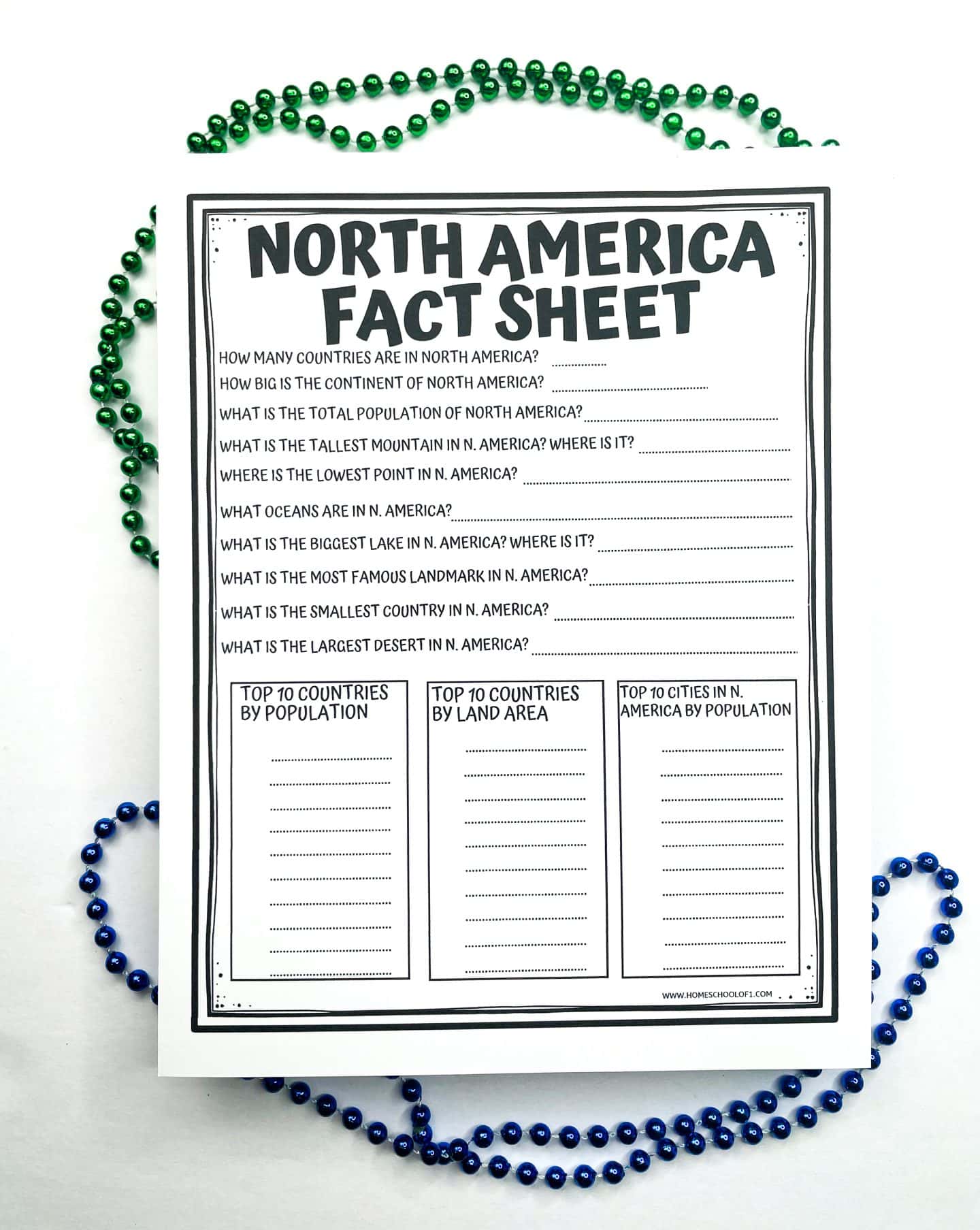
The worksheet also includes three ranking charts that students can complete:
Top 10 Countries by Population in North America
- United States
- Mexico
- Canada
- Guatemala
- Haiti
- Dominican Republic
- Cuba
- Honduras
- Nicaragua
- El Salvador
Top 10 Countries in North America by Land Area
- Canada
- United States
- Mexico
- Nicaragua
- Honduras
- Cuba
- Guatemala
- Panama
- Costa Rica
- Belize
Top 10 Cities in North America by Population
- Mexico City, Mexico
- New York City, USA
- Los Angeles, USA
- Chicago, USA
- Washington DC, USA
- Boston, USA
- San Francisco, USA
- Toronto, Canada
- Philadelphia, USA
- Dallas, USA
Pair your North America geography worksheets with the World card game. A fast-paced game that helps kids memorize countries, flags, and capitals through play.
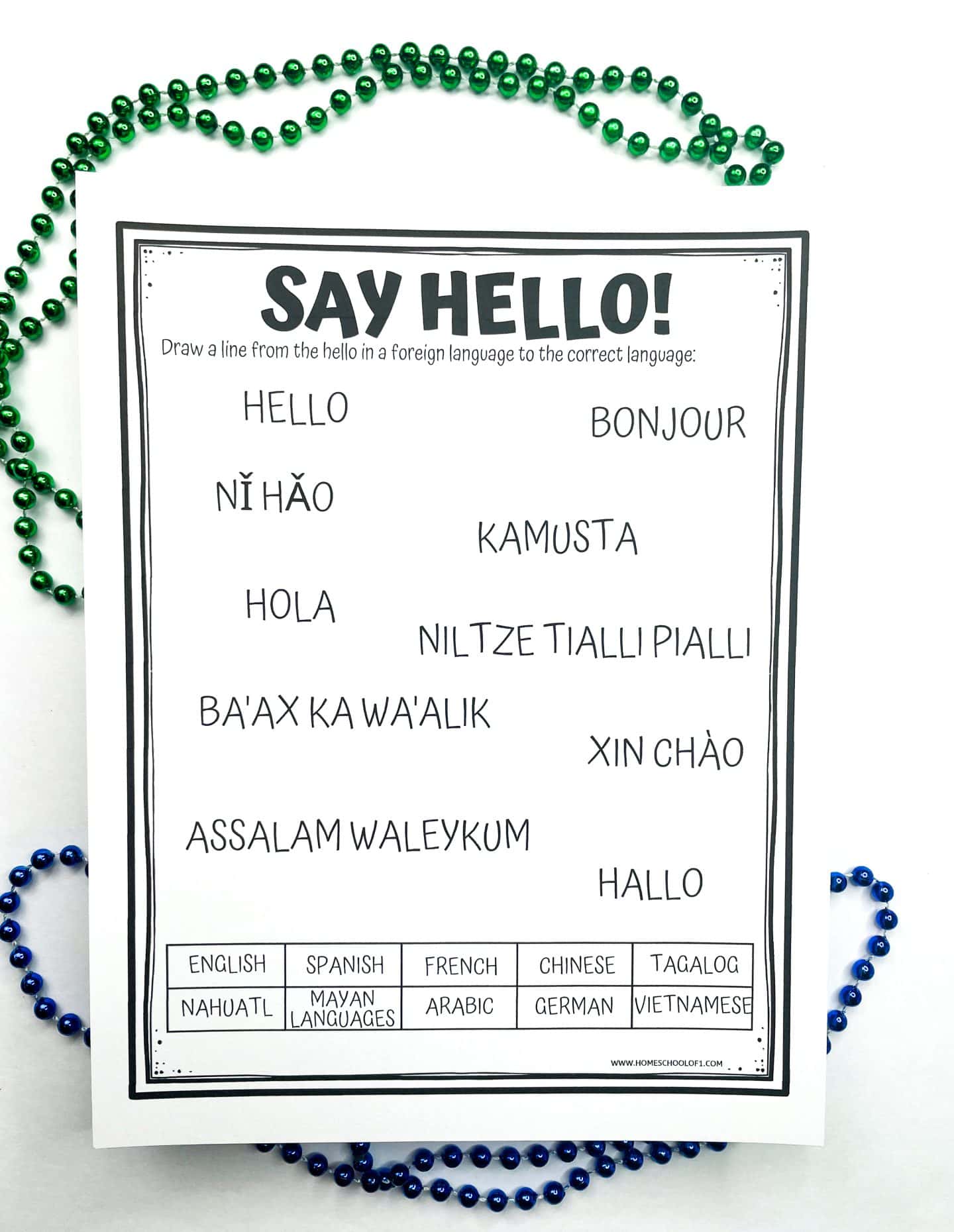
Say Hello in North America’s Most Spoken Languages
English and Spanish are the two most widely spoken languages across North America.
English is the primary language in the United States and Canada, with over 330 million speakers.
Spanish is spoken throughout Mexico, Central America, and parts of the Caribbean, with around 200 million speakers.
But those aren’t the only languages you’ll hear on the continent. Many communities speak additional languages, both modern and Indigenous:
- French – Spoken in Canada and Haiti (approx. 18 million speakers)
- Chinese – Found in the U.S., Canada, and Mexico (approx. 5 million)
- Tagalog – A Filipino language, spoken by 2 million in North America
- Nahuatl – Indigenous to Mexico, with 2 million speakers
- Vietnamese – Around 1.5 million speakers across the continent
- Mayan languages – Indigenous to Mexico and Central America (1.5 million)
- German – About 1.3 million speakers in North America
- Arabic – Also spoken by around 1.3 million people
The worksheet includes a fun activity where students match each greeting with the correct language. It’s a great way to explore the cultural diversity of the continent.
Greetings to match:
- Hello – English
- Ni hao – Chinese
- Bonjour – French
- Xin Chao – Vietnamese
- Hola – Spanish
- Kamusta – Tagalog
- Hallo – German
- Ba’ax ka wa’alik – Mayan
- Assalam Waleykum – Arabic
- Niltze Tialli Pialli – Nahuatl
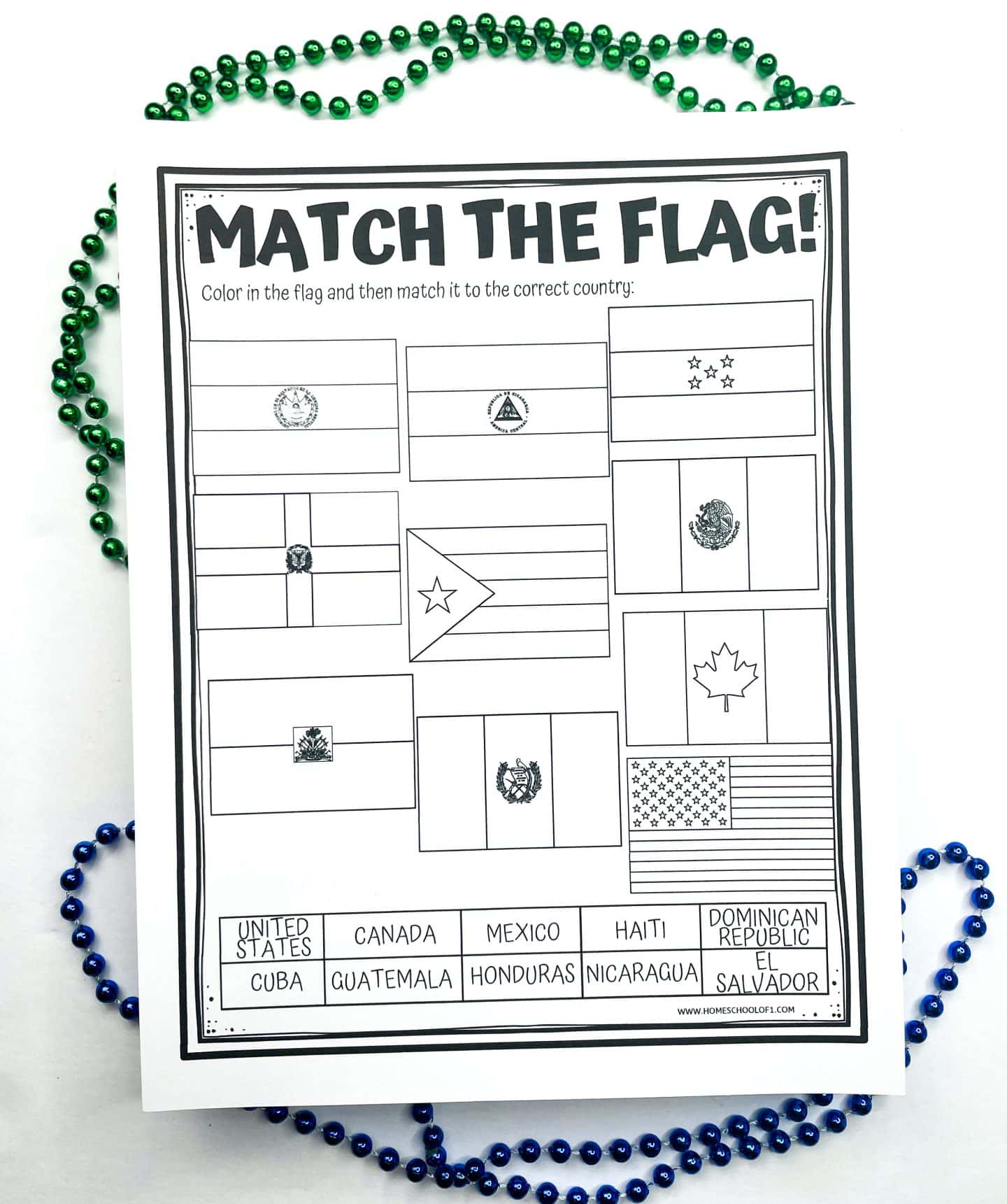
Match the North American Flag Worksheet
This interactive worksheet lets kids explore the flags of 10 North American countries while reinforcing geography skills.
First, students research and color each flag using accurate colors. Then, they draw a line from each flag to the correct country on the map.
It’s a great mix of visual learning, map skills, and cultural awareness, perfect for independent work or a small group activity.
Countries featured:
- United States
- Canada
- Haiti
- Dominican Republic
- Mexico
- Guatemala
- El Salvador
- Honduras
- Cuba
- Nicaragua
To build on this, you could also try a flag identification game like 100 Pics for more visual memory practice.
North America Word Search
This printable word search is a fun way for kids to reinforce their knowledge of the nations in North America while practicing spelling and visual scanning skills.
Words are hidden in every direction, horizontal, vertical, diagonal, forwards, and backwards, making it just the right level of challenge for upper elementary students.
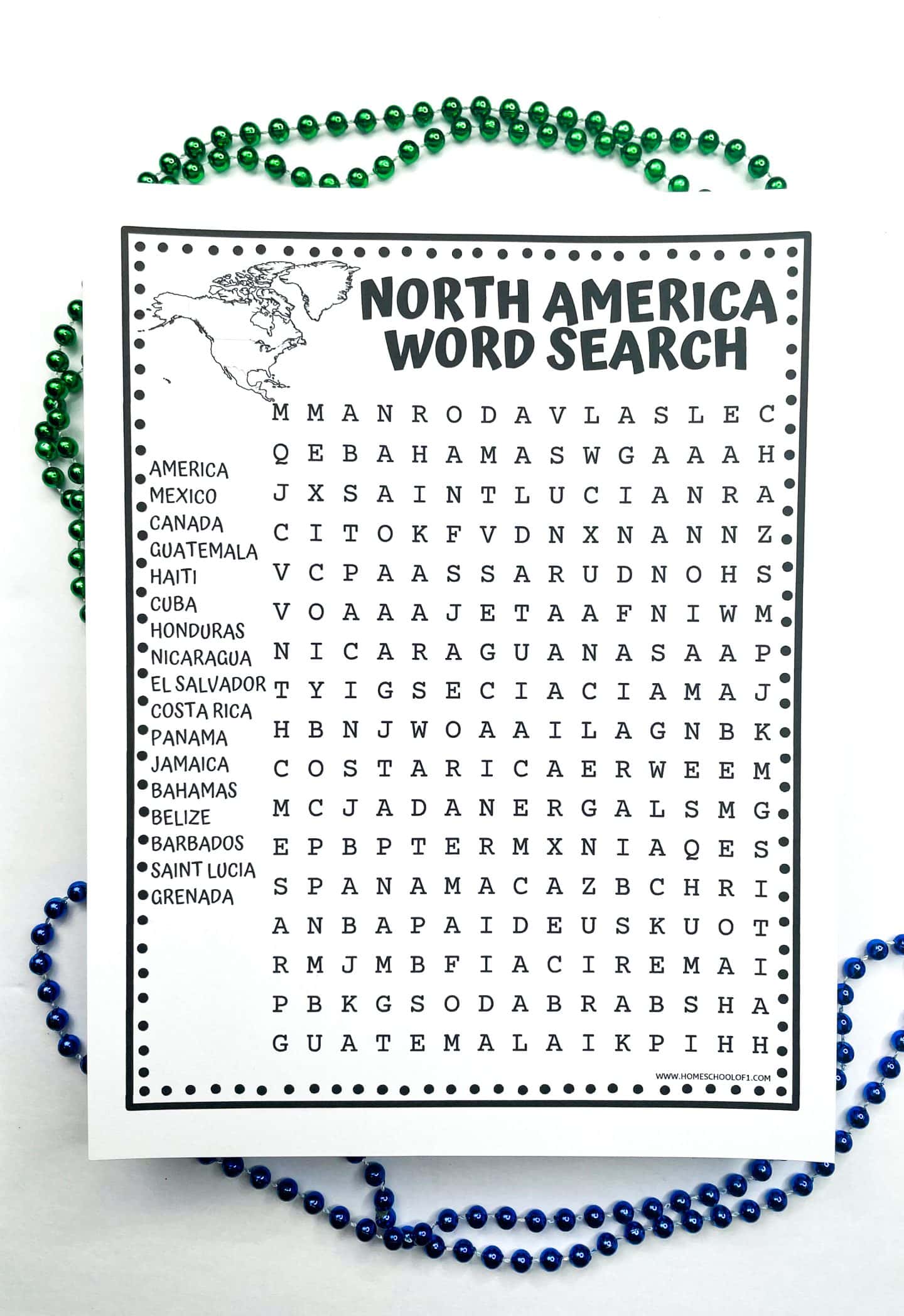
Countries included in the puzzle:
- America
- Mexico
- Canada
- Guatemala
- Haiti
- Cuba
- Honduras
- Nicaragua
- El Salvador
- Costa Rica
- Panama
- Jamaica
- Bahamas
- Belize
- Barbados
- Saint Lucia
- Grenada
Answer key included for easy checking.
Tip: Use a highlighter or circle the letters, avoid crossing them out, as some letters are part of multiple words.
This word search is a great low-prep option for classroom downtime, early finishers, or geography review at home.
North America Word Scramble
This printable word scramble is a great way for kids to review the names of North American countries while practicing spelling and problem-solving skills.
There are no clues, just a jumbled list of 12 countries from the continent, making it a fun challenge for upper elementary students.
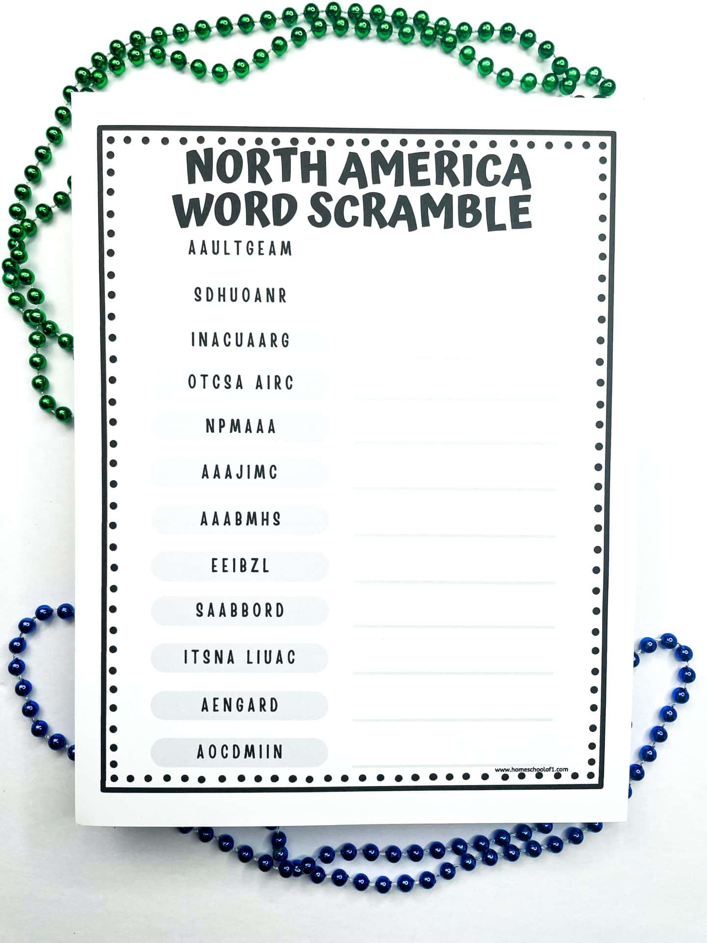
Countries to unscramble:
- Guatemala
- Honduras
- Nicaragua
- Costa Rica
- Panama
- Jamaica
- Bahamas
- Belize
- Barbados
- Saint Lucia
- Grenada
- Dominica
Answer key included for quick checking. This no-prep activity works well in the classroom, library, or at home, perfect for a quiet time filler or geography warm-up.
WANT ALL OF THE CONTINENTS WORKSHEETS NOW?
Books About North America for Kids
If you’re looking to expand on the geography worksheets with some engaging nonfiction, these books are a great place to start. They cover everything from wildlife and landmarks to Indigenous cultures and real-world exploration.
Recommended titles:
- National Geographic Bird Guide of North America – A visual guide to birds found across the continent, perfect for nature-loving kids.
- Native People of North America for Kids – An introduction to Indigenous cultures, history, and traditions.
- Native American Stories for Kids – A collection of folktales that highlight the stories and beliefs of Native peoples.
- US Road Trip Atlas – A kid-friendly road atlas with maps, fun facts, and travel tips for all 50 states.
- National Geographic Kids Encyclopedia of American Indian History and Culture – A detailed, photo-packed reference for deeper learning.
These pair well with your geography unit, and for even more fun, check out our seven wonders of the world worksheets.
More Free North American Geography Printables
If you’re looking to go deeper into North America, these additional geography worksheets offer a variety of ways for kids to explore the culture, landmarks, and history of the continent, especially the United States and Canada.
- American Landmarks Printable – Introduce kids to famous U.S. landmarks like the Grand Canyon, Mount Rushmore, and the Golden Gate Bridge. Includes short facts and interactive activities.
- State Facts Worksheet – A fun way to learn about U.S. state capitals, geography, and unique historical facts. Great for state-by-state studies.
- USA Coloring Pages – These printable pages feature national symbols, major cities, and state capitals to help kids learn through coloring.
- Statue of Liberty Worksheet – Explore the history and symbolism of this iconic landmark through themed coloring and writing prompts.
- Continent Worksheets – Build on your North America unit with worksheets covering major countries, landforms, and cultural highlights across the continent.
- Canada Day History Worksheet – A simple fill-in-the-blank activity to help younger students learn about the history and celebration of Canada Day.
These make great additions to any geography unit, whether you’re studying the whole continent or focusing on one country at a time.
Get the Free Printable North American Worksheets Here!
Ready to grab your free printable? Just pop your name and email into the form below, and it’s all yours!
Tip: Use a personal email address (like Gmail), school or work emails sometimes filter printable links.
If you don’t see the form below, click here to get the free PDF.
Last Updated on 23 October 2025 by Clare Brown