Free Continents Worksheet for Kids | Fun Geography Printables
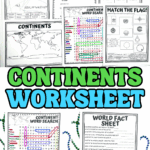
Understanding the world starts with a solid grasp of its seven continents, and this continents worksheet makes learning geography fun and interactive.
With engaging activities like map labeling, country matching, and fact sheets, kids can explore different regions while reinforcing key concepts.
These free geography printables are perfect for teachers looking to enhance their curriculum or parents seeking hands-on learning at home.
Whether coloring maps or solving word scrambles, this resource helps young learners build a strong foundation in world geography.
**This post may contain affiliate links. As an Amazon Associate and a participant in other affiliate programs, I earn a commission on qualifying purchases.**
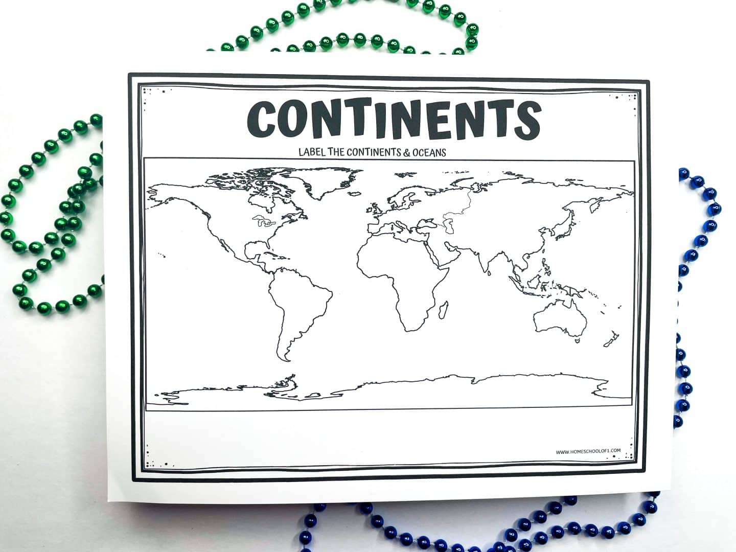
Printable Continents and Oceans Map Activity
Students can color each continent, label the oceans, and reinforce their understanding of world geography through hands-on learning.
When my son colored the continents and labeled the oceans, it helped him see just how much of our planet is water.
They can also test their knowledge by labeling the continents and oceans without a guide or using the worksheet as a reference tool for map studies.
For an extra challenge, have students pick a random country and then identify which continent it belongs to before completing the map activity.
For an interactive way to reinforce geography skills, try the Mapology World Map game. It’s a hands-on learning tool that helps kids recognize countries while making geography fun and engaging.
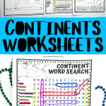
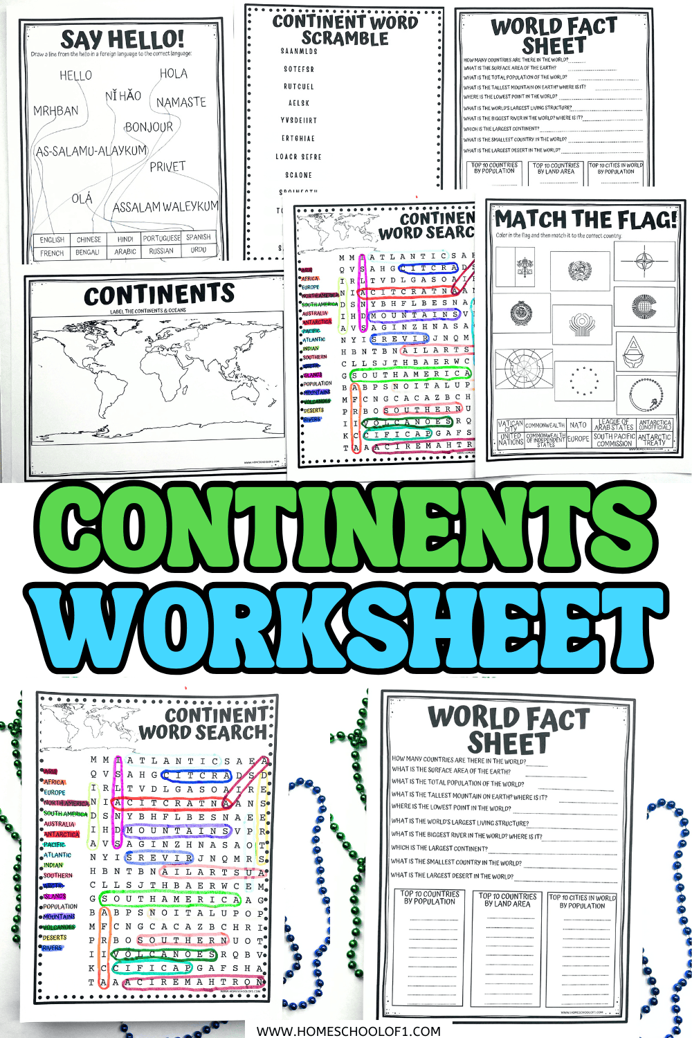
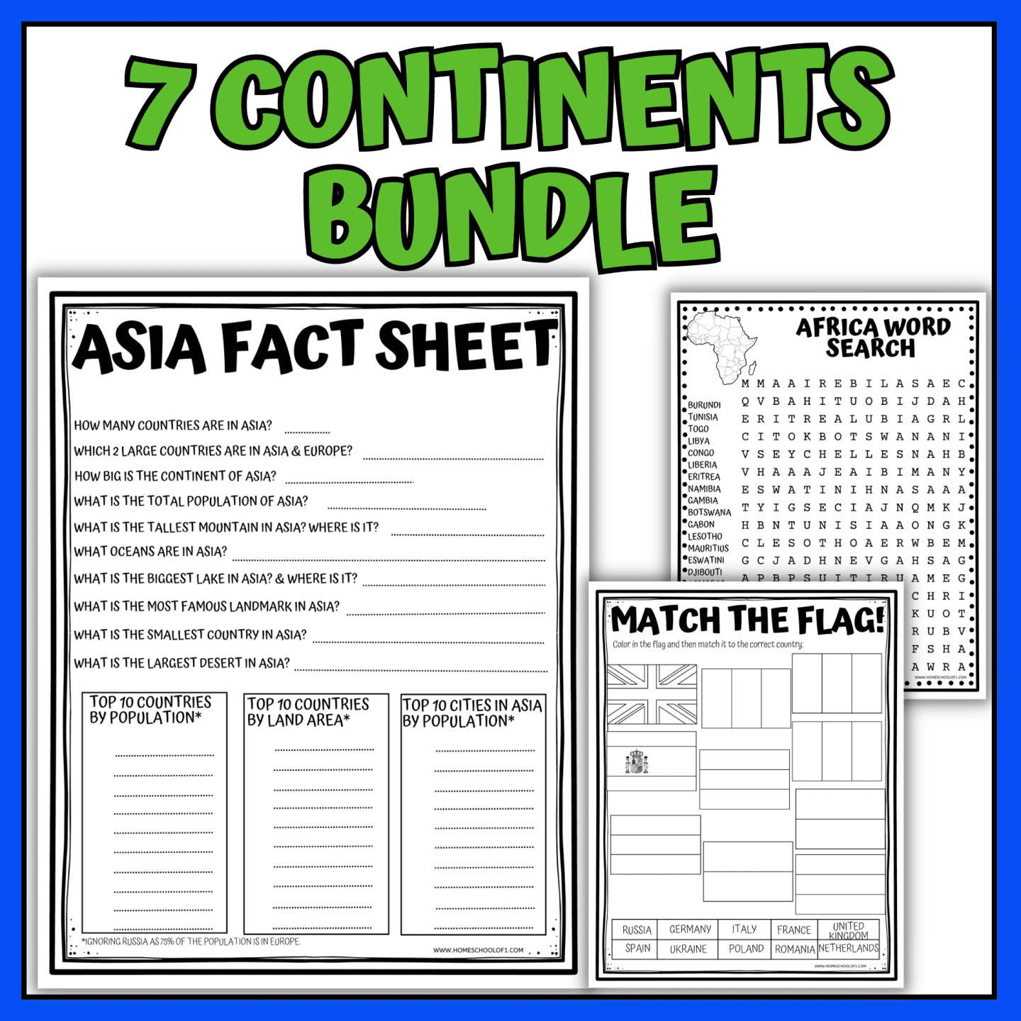
World Fact Sheet
This fact sheet helps kids explore key global geography facts through 10 essential questions about the continents, world landmarks, and geographical extremes.
It also includes the top 10 countries by population, land area, and the largest cities.
- How many countries are in the world? 195
- What is the surface area of the Earth? 196.9 million mi²
- What is the total population of the world? Over 8 billion in the world today
- What is the tallest mountain on Earth? Where is it? Mount Everest, between Nepal & Tibet
- What is the lowest point in the world? Where is it? Dead Sea, Jordan/Israel
- What is the world’s largest living structure? The Great Barrier Reef, Australia
- What is the biggest river in the world? Where is it? Nile, Africa
- Which is the largest continent? Asia, covering about 30% of the Earth’s land area
- What is the smallest country in the world? Vatican City, Europe.
- What is the largest desert in the world? Antarctic Desert.
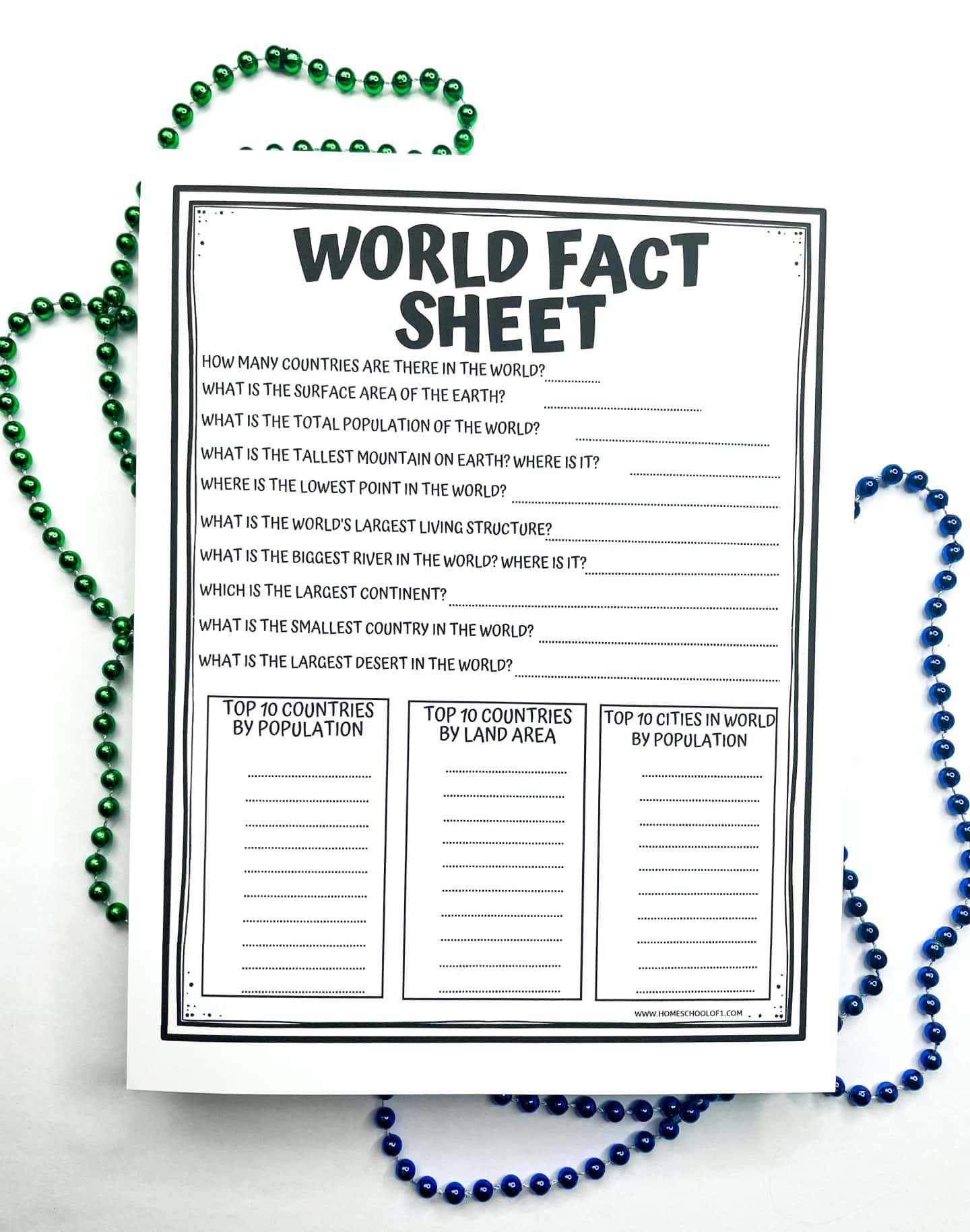
Top 10 Countries by Population
- China
- India
- United States
- Indonesia
- Pakistan
- Brazil
- Nigeria
- Bangladesh
- Russia
- Mexico
Top 10 Countries by Land Area
- Russia
- Canada
- China
- United States
- Brazil
- Australia
- India
- Argentina
- Kazakhstan
- Algeria
Top 10 Cities by Population
- Tokyo, Japan
- Delhi, India
- Shanghai, China
- Sao Paulo, Brazil
- Mexico City, Mexico
- Cairo, Egypt
- Dhaka, Bangladesh
- Beijing, China
- Mumbai, India
- Osaka, Japan
For a fun way to test geography knowledge, try the World Card Game, which challenges players to identify countries, capitals, and landmarks.
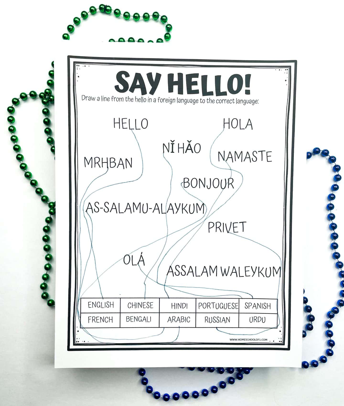
Learn to Say Hello Around the World
One of my favorite parts of these continent worksheets is the “Hello” activity. When we first tried it at home, my son couldn’t stop laughing as he practiced each new greeting, especially when he realized how different they sounded from English.
The worksheet asks kids to match common greetings with the right language and the continent where it’s spoken. It’s a simple activity, but it opens the door to talking about culture as well as geography.
Greetings included:
- Hello – English
- Ni hao – Chinese
- Namaste – Hindi
- Hola – Spanish
- Bonjour – French
- Bengali – Assalam Waleykum
- Merhaba – Arabic
- Ola – Portuguese
- Privit – Russian
- As-Salamu-Alaykum – Urdu
Activities like this make the continents feel more connected and remind kids that geography is about people as much as it is about maps. We also like using a continents connections game to group countries, landmarks, languages, and physical features by category for a more challenging geography review.
Flags of the World Printable
This activity is a little different and works best for older kids who are ready for a challenge.
Instead of focusing on individual countries, the flag-matching activity introduces students to global organizations, treaties, and unique regions that don’t always have traditional national flags.
It’s a great way to extend geography lessons beyond maps and into how nations work together. Students can research the designs, color them in, and then match each one to the correct organization or region.
Flags Included:
- Vatican City – The smallest independent country in the world.
- NATO – A political and military alliance ensuring security among its members.
- Antarctic Treaty – Represents the agreement to keep Antarctica peaceful and dedicated to scientific research.
- Antarctica (Unofficial Flag) – While Antarctica is not a country, it has an unofficial flag often used to represent the region.
- United Nations – A global organization that promotes international peace and cooperation.
- Commonwealth of Independent States – A regional alliance formed after the dissolution of the Soviet Union.
- League of Arab States – A cooperative organization of 22 Arab nations focused on economic and political collaboration.
- European Union (EU Flag) – Represents both the European Union and the broader identity of Europe.
- Commonwealth – A political association of 56 member states, primarily former territories of the British Empire.
- South Pacific Commission – An international development organization supporting 22 Pacific island nations and territories.
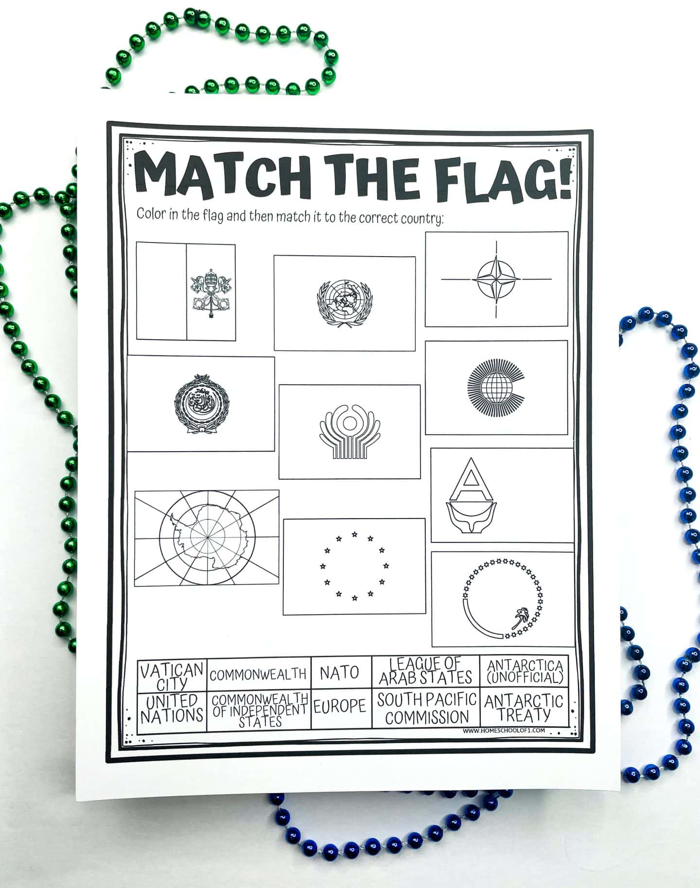
This printable goes deeper than the basics, encouraging students to connect geography with global politics and history. It’s a good pick for middle schoolers or advanced learners who are curious about how the world is organized.
For an extra challenge, try the 100 pics card game, where players test their knowledge of world flags!
Continents and Oceans Word Search
This challenging word puzzle helps kids reinforce their knowledge of continents, oceans, and major geographical features in a fun and engaging way.
Words can appear horizontally, vertically, diagonally, forward, or backward, making this a great brain workout!
To help with trickier words, an answer key is included.
Kids can use a highlighter or set a timer to make the puzzle more challenging.
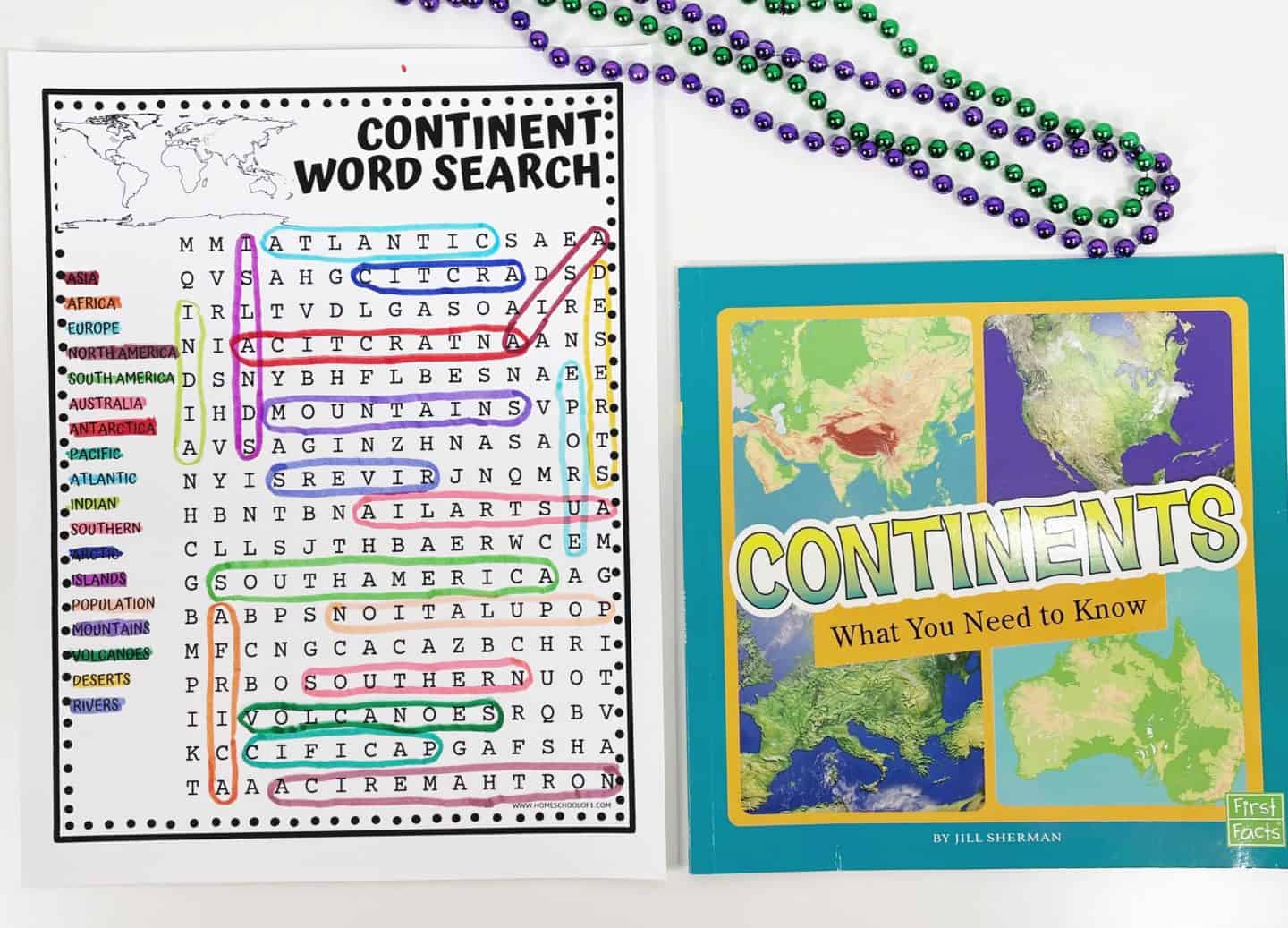
Words to Find
- Asia
- Africa
- Europe
- North America
- South America
- Australia
- Antarctica
- Pacific
- Atlantic
- Indian
- Southern
- Arctic
- Islands
- Population
- Mountains
- Volcanoes
- Deserts
- Rivers
These free word search printables are perfect for classroom activities, homeschooling, or just a fun geography break!
Continent Word Scramble
The word scramble challenges kids to solve 12 geography terms connected to continents and their unique features
With no clues provided, students will rely on their knowledge of geography terms to solve the puzzle!
An answer sheet is included to check their work.
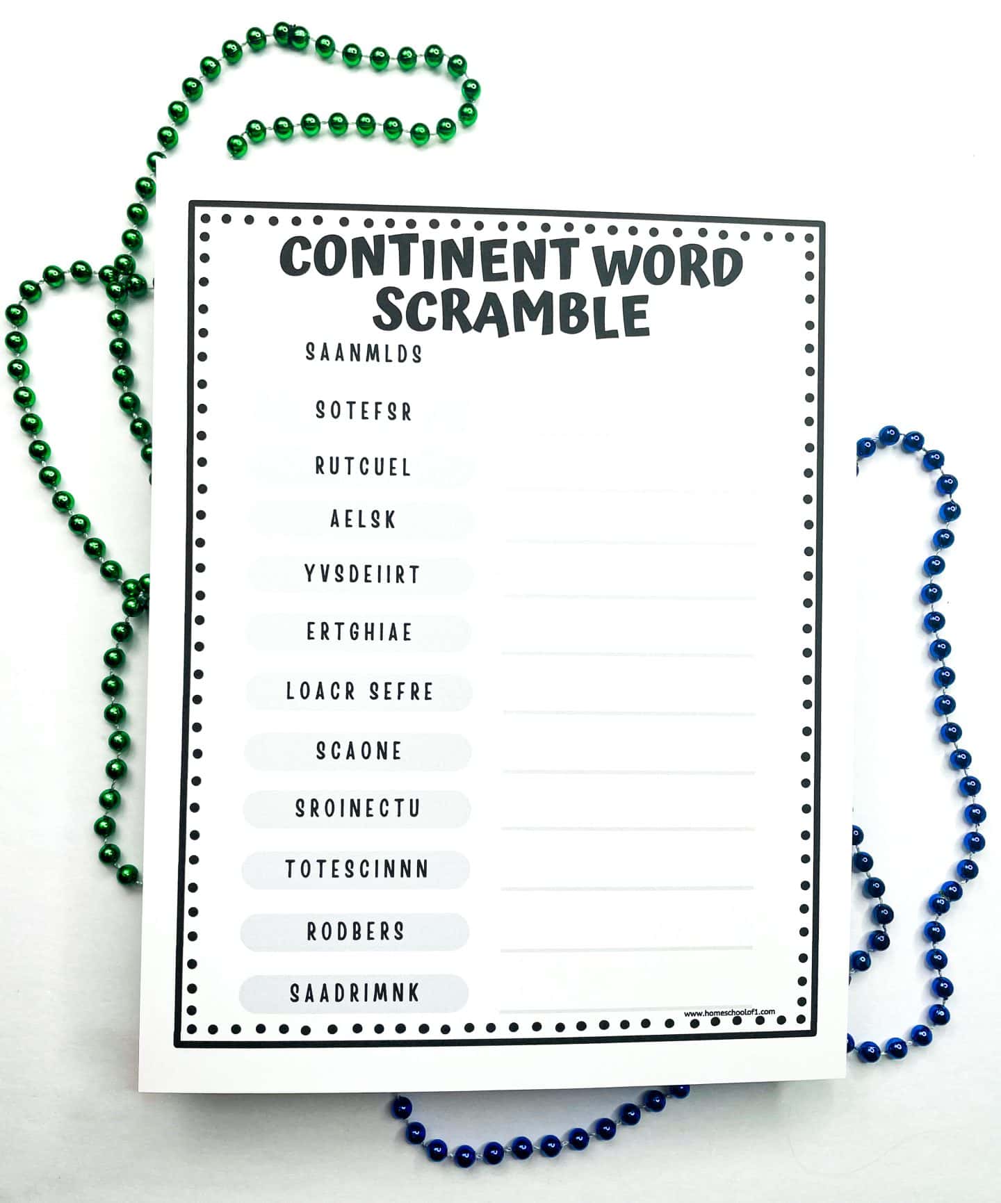
Words to Unscramble
- Landmass
- Forests
- Culture
- Lakes
- Diversity
- Heritage
- Coral reefs
- Oceans
- Countries
- Continents
- Borders
- Landmarks
Best Books About Continents for Kids
Explore the world through top geography books that help kids learn about continents, countries, and natural landmarks.
These books offer fun facts, interactive activities, and detailed maps to make learning geography exciting!
- All Countries, Capitals, and Flags of the World – A visual guide to the world’s nations, their capitals, and flags.
- The Fascinating Ocean Book – Learn how oceans connect the continents and influence global ecosystems.
- World Atlas sticker book – A hands-on way for kids to explore geography through stickers and interactive maps.
- Draw the World – Encourages kids to map out the continents and improve their geography skills through drawing.
- The Complete Book of Maps and Geography Workbook – Filled with activities on continents, landforms, and map reading.
- Continents: What you need to know – A kid-friendly introduction to the seven continents, their landscapes, and cultures.
These books are great for homeschool geography lessons, classroom activities, or independent exploration.
WANT ALL OF THE CONTINENTS WORKSHEETS NOW?
Get Your Free Printable Continents Worksheet Here!
Ready to grab your free printable? Just pop your name and email into the form below, and it’s all yours!
Tip: Use a personal email address (like Gmail), school or work emails sometimes filter printable links.
If you don’t see the form below, click here to get the free PDF.
More Continent Printables
If your kids enjoyed these continent worksheets, you might also like these extra activities. Each one gives students a hands-on way to explore different regions of the world.
- Africa worksheets – Study Africa’s diverse ecosystems, countries, and famous landmarks.
- Antarctica printables – Discover the icy landscapes and fascinating wildlife of the southernmost continent.
- Europe worksheets – Learn about European countries, capitals, and cultural highlights.
- Oceania printables – Explore Australia’s geography, landmarks, and unique wildlife.
- South America worksheets for kids – Learn about the Amazon Rainforest, Andes Mountains, and more.
Last Updated on 23 October 2025 by Clare Brown
I would love access to free printables for the World Regions, please.
Hi Tiffany,
Thanks for your interest in the Continents printables.
To get access, simply scroll to the bottom of the page and enter your email address in the signup form. You can also use this direct link:
https://homeschoolof1.kit.com/5e6c11c23a
Once you’ve submitted the form, the printables will be sent straight to your inbox.
Thanks,
Clare
I would love the continental worksheets please. Thank
you.
Hi Amanda, lovely! Use the form in the post to get the free continents worksheets; pop in your name and email and the PDF will arrive right away.
Clare
hi i would love to receive this worksheets thank you.
Hi Chana, I’m so glad you’re interested!
To receive the free PDF, please enter your email in the box at the bottom of the post that says ‘Get your free Continents Worksheet here.’ Let me know if you need any help!
Thanks
Clare